
Rocky Mountain ladies, get your snorkels out because the next couple days are going to see double digit snowfall totals. The perferct snow storm is headed towards the Wasatch Range and nearly all of Colorado, and has already landed in Wyoming’s Tetons. The snow storm is expected to drop anywhere from the better part of a foot of snow to nearly three feet in parts of Colorado. 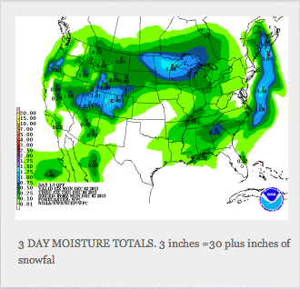
can i buy Latuda in mexico An excerpt from Powderchasers.com
Nearly a foot of new snow has fallen in the Tetons especially on the West side of Teton Pass, and further north towards Yellowstone. The Cascades are seeing moderate snow with a convergence zone setting up over http://stephanepereira.com/wp-content/themes/mero-magazine/ws.php Stevens Pass (Only 6 inches new as of 5 a.m. yesterday). Warmer air has moved into Wyoming bringing snow levels up to 7,000 feet and some rain reported in the Star Valley around Jackson. Snow levels will have dropped by late Monday mornin! Grand Targhee hit 100 inches of YTD snowfall Sunday morning!
Sharp cold front will slam into Wyoming during the late AM today bringing another round of moderate snow (3-7) to theTetons and 25 degree drops in Temperatures. Cold front makes it to theWasatch in Utah around 7AM Tuesday bringing several hours of heavy snowfall to the Wasatch under SW flow. This will favor areas like Brighton, Solitude, Snowbasin and Powder Mountain. Expect 7-9 inches during the day Tuesday and another 4-9 by Wednesday morning (Cold orographics might keep light snow falling over the Wasatch until Wednesday night). Snow totals could range in the 11-16 inch range especially in Big Cottonwood. Surprises could be found in Park City as well as Snowbasin (SW flow). Central and Southern Utah will get even deeper amounts!
Colorado will fare deep with the cold air to the north and some moisture tap from the south. Steamboat will fare well with the Cold Front Tuesday morning into the afternoon (4-10). Another 5-11 could fall over Steamboat Tuesday night! Snow will migrate to central Colorado during the late afternoon Tuesday and become stationary through Wednesday. Expect 2-3 foot snow totals over the Grand Mesa, and 15-25 inches from Aspen to Crested Butte and Powderhorn. A bullseye seems to set up over either Aspen or the Butte. Winds go from SW (Good for the Butte Tuesday night) to the North (Better for Aspen). All mountains in Colorado will snowfall! Expect the deepest days to be up north (I-70 to Steamboat) on Tuesday afternoon and in Central Colorado on Wednesday. Southern mountains including Silverton will grab a foot or more. Wolf Creek might see 6-10. The chase might take me from Steamboat on Tuesday to Aspen or Vail on Wednesday. Vail and Summit County will fare decent amounts primarily Tuesday PM into Wednesday (11-14). Front Range resorts near Denver (Eldora, Loveland) will see 5-11 inches by Wednesday morning. Amounts could be higher!


